
We’ve swept our way 170 kilometres around the coast to the bohemian town of Kas (pronounced cash). We’re expecting big things from this town of roughly 10,000 (although the wider district is much larger at close to 50,000), with a lot of people saying it’s a much more laid back place than the other seaside resorts along the Turquoise Coast. With sparkling blue waters, loads of cool cafes and plenty of ancient Greek historical sites to check out, first impressions are that this is more our kind of place.

Kas cafe scene
With its gorgeous bays it’s easy to see why Kas has become so popular. There’s plenty to do for outdoor enthusiasts and most especially for anyone with an interest in scuba diving, as it is often regarded as the best of all the Turkish dive sites due to the range, frequency and quality of the dives.

View down to Kas from our accommodation
It’s also not a bad place to sit out on your balcony watching the sun go down over its marina with a cold Efes in hand.

Kas marina
While the town doesn’t boast quality beaches (for this you’ll need to continue another 20-30 minutes round the coast to Kaputas and Patara), it does have a number of important historical sites dating back to sometime around the 5th century BC when it acted as the port for the inland Lycian city Phellos. Known as Antiphellos, the town overtook Phellos in terms of importance around the 2nd century BC when it grew to be a major city of the region.
Probably the best known site dating back to this period is a Lycian sarcophagus called the King’s Tomb. Sometimes mistakenly called the Lions Tomb due to the lions’ head on the lid the sarcophagus its easily accessed up a Roman-era road that locals call Slippery St.

The Kings Tomb

A closer view of the lion on the sarcophagus’ lid
Equally well known is the superb first century BC Roman Theater which, when restored in the 2nd century AD, was able to accommodate 4,000 people. Looking out to the nearby Greek Island of Meis across glistening Mediterranean waters, it really is a beautiful sight. Unfortunately, I only stopped off on one of my runs without a camera so wasn’t able to get any photos.
Kas’s bohemian reputation is mostly due to the boutique shops, restaurants and bars that line the cobbled streets in its historical centre. Here you can wander without fear of any hassle or hard sell from vendors who seem content with simply ensuring that visitors to their town enjoy themselves. With jazz bars and even an annual jazz festival it really is a place quite different from the rest of Turkey.

Cobble streets of historic old town
Most of the ancient history here is directly attributable to the Lycians who inhabited this area of present day Turkey between the bays of Antalya and Fethiye. While it is the Greek city-states (most notably Athens) that are most commonly linked to being the first to implement democratic instituations in the 5th century BC, the Lycian’s put in place the first known democratic union in history, called the Lycian League. In fact, the ancient Greeks admired the Lycians and the way in which they were able to achieve a larger political unity, as their own city-states were contantly at war with each other, whilst the Lycian cities enjoyed peace amongst themselves. Such was the power of Lycia that it was also the last region on the entire Mediterranean coast to be incorporated as a province into the Roman Empire and even then the Lycian Union continued to function independently.
Honouring the Lycians is a 509 km way-marked footpath around the coast of Lycia called the Lycian Way. Researched, designed and implemented mostly by Kate Clow, the Lycian Way stretches from Fethiye in the west to Antalya in the east. With stunning coastal, mountain and forest scenery along its route, it has been called one of the ten most beautiful long distance hikes in the world. Consquently, I was keen to check out some of the sections along the Way and decided to start with one of the harder sections leading from Kas (Antiphellos), to the town of Cukurbag.
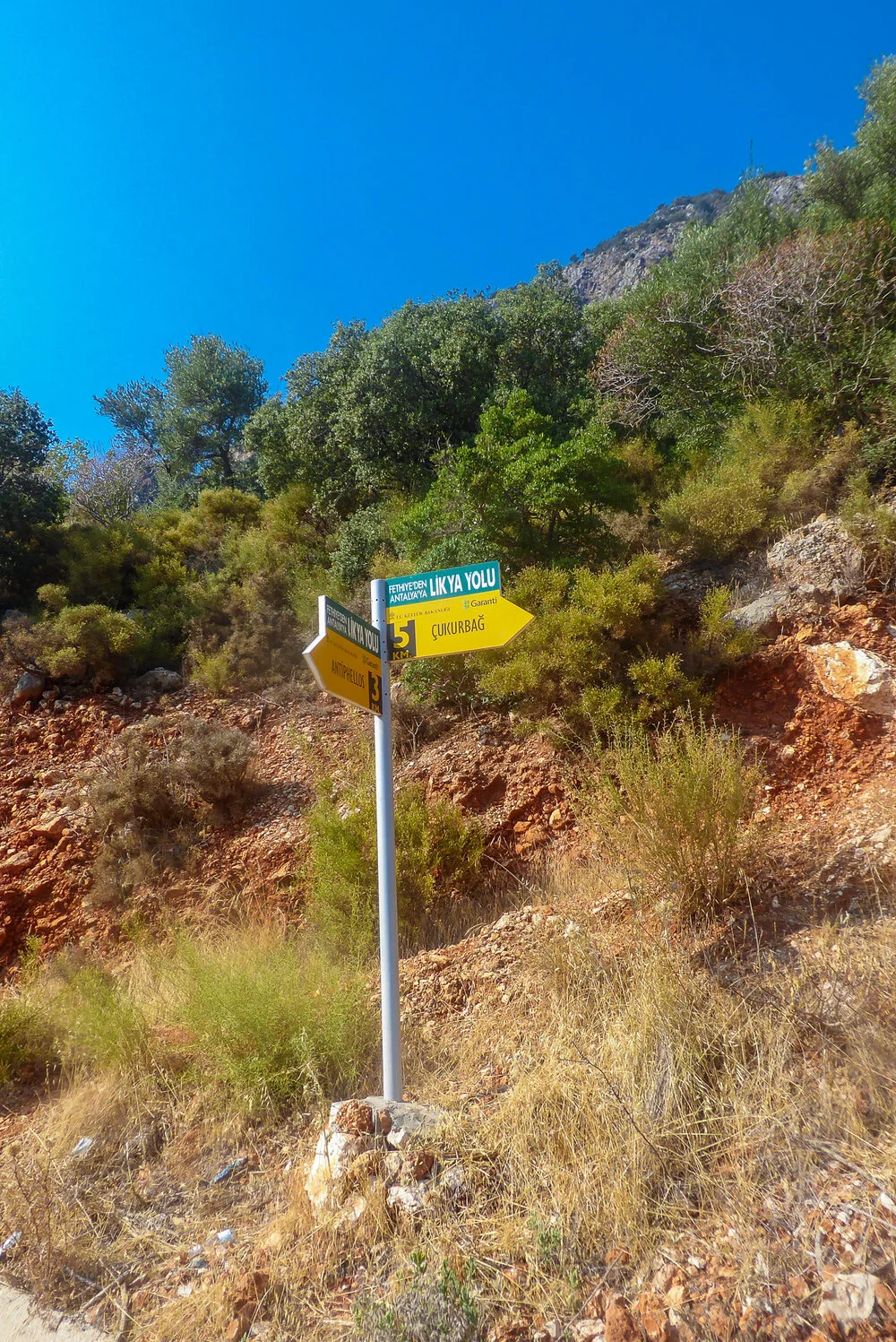
The bottom of the hill
Whilst the route I picked was supposed to be only 5 kilometres one way, the distance I covered to get to the town was considerably more. Factor in an extremely steep climb and no shade from the blazing sun and it really is a trek that shouldn’t be underestimated, However, the views back down to Kas, the peninsula and Meis in the distance definitely make it worthwhile.
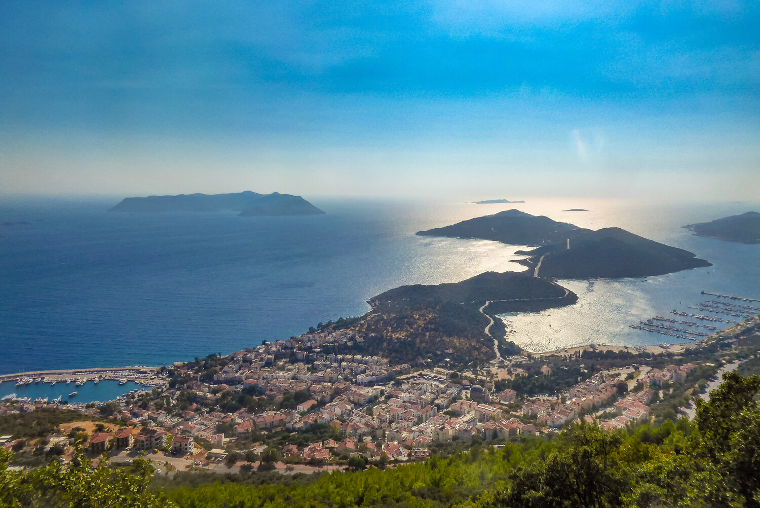
Killer views about half way up the “hill”
The trail up the mountain is rocky and has sporadic red and white paint markers to lead the way. These are usually only visible when they’re not needed and whenever there is a juncture you have to go searching for them in order to confirm that you’re still on the right track. Hence it’s worth factoring extra time for getting lost and backtracking to find the right way.
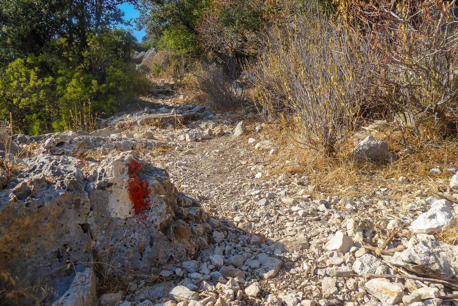
Typical way marker

View from the top
Allup, it’s probably about a 45 minute scramble to the top for most people and one which definitely requires a decent amount of fitness. Some of it is runnable, if you’re used to trails, but I imagine for the majority of people it really is just a hard slog. Finding your way to the top isn’t actually that difficult when heading up the hill, however, thereafter it does become more difficult.
I was glad I did a recce run the first day before having another crack at it, as I spent a considerable amount of time trying to find where the trail continued on from the top without any luck on Day 1. Looking at some maps later that night online enabled me the next day to continue on from the plateau at the top of the hill and then through to the town of Cukurbag. I was hoping to make Phellos, where there are supposed to be a decent amount of ruins, but distances proved a bit further then described and not wanting to get caught in the dark, I had to make my way back about a kilometre before reaching my targeted destination.

Red dirt plateau at the top of the hill
When I say the views from the top are worth it, I really mean the views from the top are freakin amazing. And being up there with the setting sun, without another soul nearby made for an unforgettable experience.

Chilled at the top

Last of the sun’s rays
Having watched the sun go down, it was now a simple task of bombing down the hill before it got too dark. Half way down I did start thinking that maybe it would’ve been a good idea bringing a flashlight, but with only one spill I made it back with plenty of time before Veronica had gone too far down the planning phase of what to do with a missing husband. Appetite whetted from my first Lycian Way adventure, I was keen to do some more at our next destination in Oludeniz.
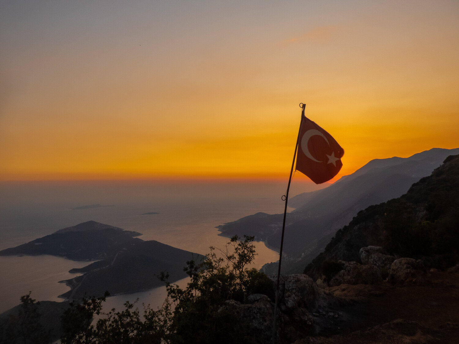
Sunset